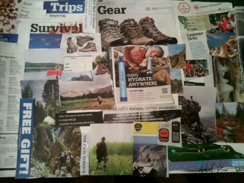
Here at Launch Day Inc we’re mountain bikers. Wanted to file a ride report on a ride we did last weekend called Cedar Canyon, though it’s actually a number of trails – Sherman Pass to Trout Creek to Schaefer Trail to Rincon to Cedar Canyon to River Trail. It’s about an hour north of Kernville at the southern endish of the Sierra Nevada.
We knew it would be a long one. We’d estimated about six to nine hours. It ended up taking 13 due to a few different things, but all things considered I think we could have done it in about nine. We lost an hour here and there to different things – looking for each other, napping, darkness, etc.
Cedar Canyon is a rugged ride, particularly the 2nd half, once you hit Rincon. I had it broken into four legs on my ride schedule. The first two legs are gorgeous. Stellar, fast Sierra mountain biking, great trail conditions, lots of fun. As you near that halfway point it starts getting “real.” The rocks come out, the steeps get rutted and softer. After that halfway point, at Rincon, it becomes a rugged ride. Lots of pushing. Beautiful scenery, but a good hard ride. “Bushy down there” they had said, and yes on the Cedar Canyon component it got a little bushy for a bit.
Leg 1 – Trout Creek. Drop 900ish feet, climb back out the other side. Estimated 1 hour. Took 2.
Leg 2 – The fun 2 hour descent. 4000 foot descent. Estimated 2 hours, took 3. Georgeous.
Leg 3 – Rincon. Punishing rutted rollers to hike-a-bike up and down. Estimated 1 hour, took 2 I think.
Leg 4 – Cedar Canyon and River Trail. Gorgeous rugged canyon 700 feet descent for a mile. Estimated 30 mins, took 1 hour w/ stops and some sketchy sections. Awesome canyon, drops you out at the Kern. Then you ride River Trail, a 4 mile, slow gradual loss of 400 feet. Estimated 2 hours, took more like 3 (moving). Really pretty section but plenty of sections to hop off and push. A better way to put it is, there were several sections where we could hop on and ride. We lost light here halfway and chilled for an hour or two waiting for the moon, so really it was more like 5 hours or total so on this section. We were pretty cooked so it took us longer to get out than it would have were we fresh. As if we’re ever fresh.
Don’t do this ride w/o GPS and know how to use it. You’ll just get out there and get lost otherwise. Plan ahead. Have a map too, like the good kernriversierra.com map. Have water purification tablets for this one, or just suck up creek water, which there is plenty of. We refilled our camelbacks and water bottles in Durwood Creek when we ran out, the water was delicious and cold. the tablets were nice to have. and mock me if you must but one of those shiny little vacuum sealed emergency blankets are a good idea to shove into your camelback in case you have run out of light like we did. I sacked out in mine when we lost light and had a wonderful little nap under the stars. They work great, harnessing the magic of body heat. Then we got up when the moon came out and went our merry way.

So the first leg starts at Sherman Pass, roughly the same place as the great Cannel ride but going the other way. Rocky and technical right out of the gate, but good fun.

This leg ends with a climb, it’s a nice slow grinder through pretty woods, nothing crazy, just a sustained climb, for me about 35 or 40 minutes.
Then you get to the top and start the next leg, a beautiful long descent, fast and flowy singletrack, hugging a creek for a ways, very nice. This was the jewel of the ride. Enjoy it. You end up dropping (I think) from 8800 down to 5000 when you connect up with Rincon. There’s some brief climbs towards the end, and I admit, it was towards the end of this leg I started getting pretty pooped. Some of those drops started getting rocky, sandy, soft or rutted, so I got shaky arm syndrome around there from fatigue. Definitely a mojo tester but well worth it. A ton of fun.

Then at the end of that leg, there’s a signless junction with Rincon. We chilled out for a bit, ate snacks. The trail drops down really well marked to the right, unfortunately that’s the wrong trail. So we had to come back, and drop to the left. So just be sure the check your gps or map to make sure you make that turn. If you’re riding your bike, you went the wrong way. If you’re pushing your bike up a rut for 40 minutes, you went the right way. Then down. Then up. Then down. Then up. Then down. Then you can pat yourself on the back and be glad it’s over cuz the next leg is starting, a really cool drop down what I think is Cedar Canyon.
You hang a right off Rincon into the canyon and in our case it was a little bushy. It’s immediate hike-a-bike. In fact a big storm a few weeks previously had done a number on the trail. It’s basically a granite wall with a goat trail cut across it. In one section it had piled up with shale you had to clamber over. Another section had like a big boulder or something over the trail, we were wondering where the trail had gone, but we dragged our bikes across it and picked up the trail on the other side.

There’s a a cave too.
It drops you onto the Kern River, where you eventually clamber back to Johnsondale Bridge. This trail called River Trail meanders along the south side of the Kern River, really pretty. We passed a few backpackers going the other direction. There were certainly some more hikeabike sections here, you’ll want a little gas left in the tank to deal. This nasty little number is I believe at the start of the trail:

After a few miles of this you get back to Johnsondale Bridge, where hopefully you’ve stashed a car.
Rugged ride, glad we did it.